Design preview for review · not the live site

Utility and underground scanning

Find what is underground before the excavator does.

Proceq GS8000 ground radar, stepped-frequency 40 to 3440 MHz, with MA8000 GNSS positioning and real-time 3D tomography on site.

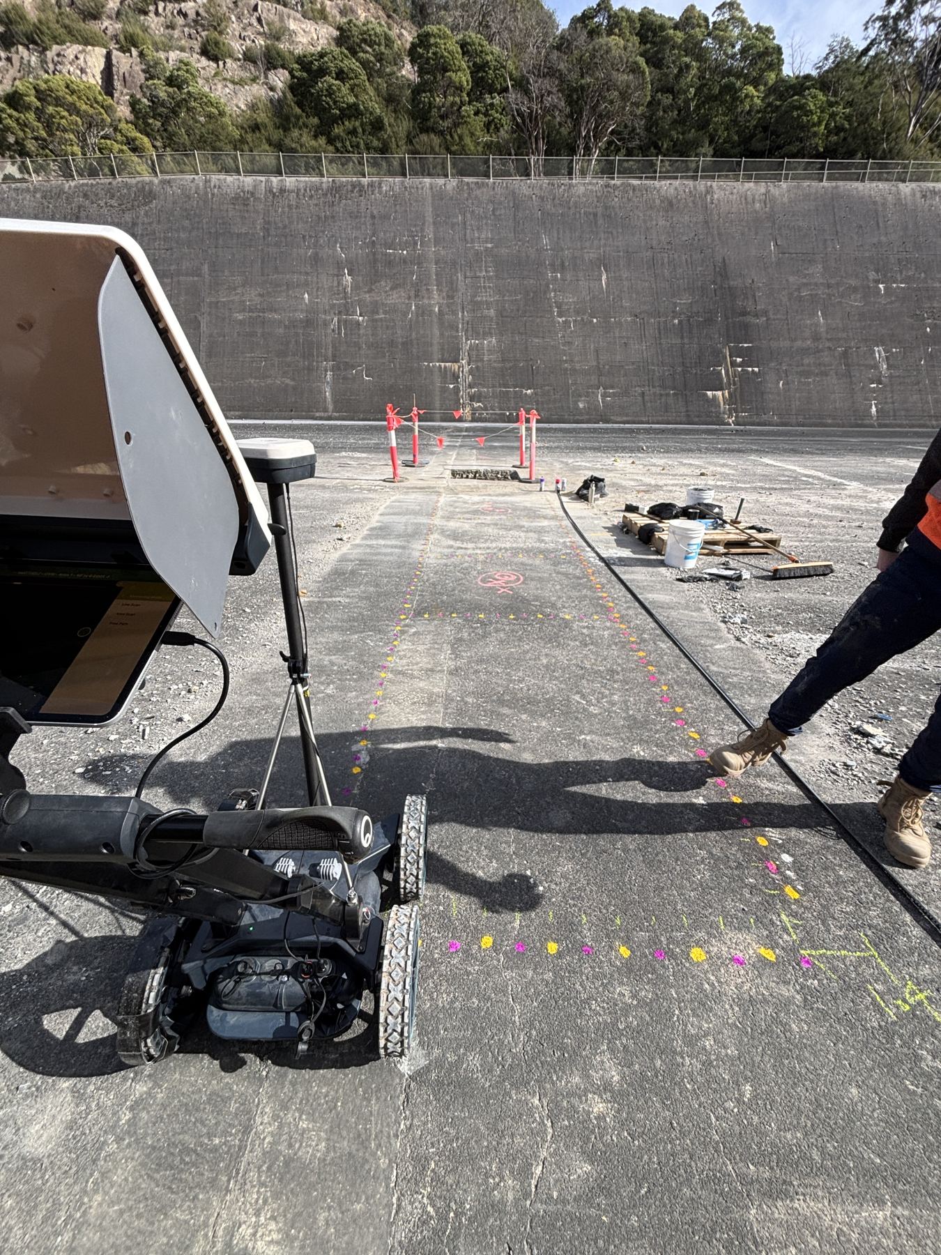
Operator marking scan results in paint beside the GS8000 on a concrete surface
Passes and targets paint-marked as we scan

We put the underground on your survey

Every line placed on the map.

Scan lines are positioned with GNSS on GDA2020 MGA55 and can be tied to your surveyor's control, so located services drop straight into CAD and GIS.

DXFSHPKML / KMZCSVGeoTIFF depth slicesSEG-Y
Underground utility scanning

Service plans are often wrong. Scan first.

Water, sewer, stormwater, electrical, communications and gas services located before excavation.

  • Works alongside your Before You Dig Australia plans; it does not replace them
  • MA8000 GNSS positioning places every scan line on the map
  • Free-path scanning: we follow the services, not a rigid grid
  • Reports for engineering, council and utility-mapping submissions
Book a scan
Underground power scanning

Mains power located before you dig or core.

Power conduits and cable routes found and marked on the surface.

  • GP8000 detects mains power to at least 2 m, clearly visible within 1,200 mm
  • GS8000 sees it up to 4 m deep in Melbourne ground conditions
  • For electrical contractors, project managers and building surveyors
  • Especially useful on older properties where power was never recorded
Book a power scan
Watermain scanning

Locate watermains, including plastic pipe.

GPR finds non-metallic pipes that standard electromagnetic locators can miss.

  • Position and depth before works begin
  • Helps reduce the risk of flooding, outages and emergency repairs
  • Urban, commercial and infrastructure sites
  • Data integrates with your survey
Request a quote
Underground cable scanning

Protect telecommunications and data networks.

Cable routes, depths and conduit banks mapped.

  • 3D views of cable routes where needed
  • Stand-alone or as part of a full utility survey
  • Reports for engineering, council or asset-management use
Book a cable scan
General subsurface

More than pipes and cables.

Voids, abandoned structures, buried tanks, old footings and backfilled excavations.

  • Pre-construction site investigations
  • Road and pavement condition
  • Dams, spillways and water infrastructure
  • Environmental and archaeological surveys, fully non-invasive
Discuss your site

Scan before you cut

Know what is in the slab before you core it.

Tell us what you are cutting, coring or digging and where. We will scope the scan and the report you need.

Request a free quote